
Lesson plan

Lesson Plan: City Planning and the Future of Cities

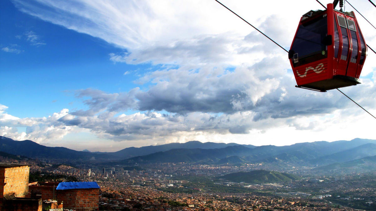
Medellín, Colombia, has undergone a remarkable transformation. For years, hillside neighborhoods were seen as too poor and dangerous to invest in, leaving residents isolated in makeshift homes. That began to change in 2004, when the city built the Metrocable, a gondola system linking the slums to the city center. The project reconnected communities and revitalized the region. In this lesson, students will explore Medellín’s story and take on a city-planning challenge of their own.
See more

Subjects:

Geography; World History

  • This lesson introduces World History students to the urbanization that occurred during the Industrial Revolution.

  • Geography students learning about cities and urban land-use patterns (AP Geo Unit 6) would also benefit from this lesson.

Grade Level:

8-12

Lesson Duration: 

  • Three 45-minute class periods. Each lesson can be taught independently.

    • Day 1: Steps #1-9: Urbanization Simulation

      • If you run out of time, step #9 can be skipped or done on Day 2

    • Day 2: Step #10: Retro Report video

      • The video is 10 minutes long. You may stop the video for each question to allow students to discuss and write responses to each question (see the time stamps on the activity sheet). Or simply show the video and have students choose one or two questions to answer.

    • Day 3: Steps #11 – #14: Mapping our town: students plan for growth in their community

      • Step #14 (having student groups explain their choices) can be eliminated if needed.

Essential Questions:

  • What factors drive urbanization?

  • How can city planners ensure all urban areas are productive and are moving towards equality?

Lesson Objectives:

Students will:

  • Develop a plan for a growing city that considers short- and long-term effects on residents and the land.

  • Defend a city-planning model that considers competing interests.
  • Construct maps to represent and explain the spatial patterns of cultural and environmental characteristics.

  • Use maps to explain relationships between the locations of places and changes in their environmental characteristics.

  • Explain how changes in transportation influenced the spatial connections among human settlements and affected the diffusion of ideas and cultural practices.

  • Explain how a government pays for the goods and services it provides.

  • Explain why advancements in technology and investments in capital goods and human capital increase economic growth and standards of living.

  • Communicate a city plan, justifying choices for building placement.

Materials:

  • Day 1: Blank paper and a pencil for each student

  • Note: Students who are absent will need to be provided the instructions for steps #3-8 on a separate handout.

  • Day 2: Retro Report film “Future of Cities” (Transcript) and Student Activity handout

  • Day 3:

  • Print out a map of an area that includes your school and 2-3 square miles surrounding your school (the Google Maps “default view” works well).

  • Print about 10-15 big copies (one for each group of 3-4 students); 26×36 inches works well.

  • A set of snap blocks or linking centimeter cubes (like LEGOs or Unifix cubes) for each student group. Your local library may have cubes for check-out, or elementary math teachers may be willing to share their sets. Starburst candy (individually wrapped squares) may be used. Ensure that each group gets the same combination of blocks. Here is a suggestion, but the number may need to be adjusted depending on the size of the map:

    • 70 small blocks to represent homes

    • 5 medium blocks to represent stores (may need to be several of the same color blocks snapped together)

    • 1 big block (may need to be several of the same color blocks snapped together) to represent a hospital

Procedure:

  1. Give each student a sheet of 18- by 12-inch paper and have them follow several rounds of verbal instructions (below) to draw a growing city. In this urbanization simulation, students will first draw a rural mountain town with a few homes and a river. Then they’ll imagine that natural resources are discovered in the mountains, and create mines. They’ll then add houses, offices and factories to support the miners, starting the process of urbanization.

  2. Begin by reading Round 1. Give them 4-5 minutes to draw as instructed. Encourage simple drawings (a square for a house and a larger rectangle for the store, for example).

  3. Round 1:

    1. Welcome to your rural village! It’s so cozy and peaceful here.

      1. Draw a river across your paper

      2. Draw some mountains in one of the corners

      3. Draw a road with a bridge that crosses your river

      4. Draw 10 houses

      5. Draw a general store/gas station

    2. A Natural Resource is discovered: Lucky you! You are hiking in the mountains and discover a beautiful gemstone that has never been seen before. After a little digging, you realize these gemstones are all over your mountains. You and your city are going to be rich!

      1. Draw a mine on the mountain where you will begin digging gemstones to sell.

      2. Draw a road that connects the mine to the city’s main road.

      3. You made lots of money selling your first batch of stones. Draw a mansion for yourself!

  4. Continue reading, giving students 4-5 minutes to draw after each reading the instructions for each round. They should feel rushed in later rounds!

  5. Round 2: Workers are Hired: You hire workers to mine your stones from the mountains, transport them to town, polish them up and sell them.

    1. Draw 20 more houses for your workers

    2. Draw a stone-polishing factory

    3. Draw an office building

  6. Round 3: More mines, more workers: You open up more mines and hire more workers. All the people in your town need services

    1. Draw two more mines in the mountains.

    2. Draw roads that connect these mines and also connect to the main road

    3. Draw 40 more houses

    4. Draw another factory

    5. Draw another office building

    6. Draw a big store

    7. Draw a school

    8. Draw a clinic

    9. Draw 10 more houses for the teachers, store clerks and health care workers.

    10. Draw roads between all the houses. Connect the roads to the main road.

  7. Round 4: Pollution problems: The factories that polish stones are polluting your river and sky

    1. Draw smoke coming from your factories

    2. Draw a hospital. People are being injured in the mines and becoming sick from pollution

    3. Draw a water treatment plant near the river

  8. Round 5: More mines, more workers: You open up even more mines and hire even more workers.

    1. Draw two more mines in the mountains.

    2. Draw roads that connect mines and connect to the main road

    3. Draw 40 more houses

    4. Draw another factory

    5. Draw another office building

    6. Draw another general store/gas station

    7. Draw a clinic, a restaurant, and another entertainment venue of your choice

    8. Draw 10 more houses for the teachers, store clerks, nurses, waiters, etc.

    9. Draw roads between all the houses. Connect the roads to the main road.

  9. Distribute the Student Activity handout. Students will next answer questions about the town they created using the maps they drew. As time allows, have students share some of their answers with the class.

  10. Show students the Retro Report video “Future of Cities” (Transcript) and have them answer the related questions on the Student Activity handout.

    1. Consider showing the video twice, stopping the video frequently to give students time to answer, or allowing students to watch the video on their own devices so they can pause the video on their own. There are time stamps to indicate where the content begins for each question.

  11. City Planning:

    1. Distribute the 26×36 maps of your school area; 1 map per group

    2. Give each student group a set of snap blocks according to the directions in the Materials section.

  12. Tell students that it is anticipated that 70 new families will be moving to the area, as will new stores and a hospital. Have students plan where to build by placing the snap blocks on the map. They can be placed on the map as single-family homes or snapped together to make apartments.

  13. After students plan their communities, have each group showcase their map and explain the city planning choices they made.

  14. After all student groups present, have students reflect on the question: What factors drive urbanization? They may consider the reasons for mapping choices made by their small group and others

Extension Activity:

Consider contacting your city’s planning commission. Often, part of the job is outreach and education. Your city may have lesson plans and/or presentations available for a variety of grade levels.

About the Author:

Jenna Vandenberg-Pontius teaches World History and Civics at a public high school near Seattle. She has taught Social Studies for over 15 years in Las Vegas, Denver and Seattle. She serves on Retro Report’s Council of Educators and is a fellow with the Auschwitz-Birkenau Memorial Foundation.

Standards

College, Career, and Civic Life (C3) Framework for Social Studies

  • D2.Geo.1.6-8. Construct maps to represent and explain the spatial patterns of cultural and environmental characteristics

  • D2.Geo.2.6-8. Use maps, satellite images, photographs, and other representations to explain relationships between the locations of places and regions, and changes in their environmental characteristics.

  • D2.Geo.2.9-12. Use maps, satellite images, photographs, and other representations to explain relationships between the locations of places and regions and their political, cultural, and economic dynamics.

  • D2.Geo.3.9-12. Use geographic data to analyze variations in the spatial patterns of cultural and economic characteristics at local, state, and global scales.

  • D2.Geo.4.6-8. Explain how cultural patterns and economic decisions influence environments and the daily lives of people in both nearby and distant places.

  • D2.Geo.5.9-12. Evaluate how political and economic decisions throughout time have influenced cultural and environmental characteristics of various places and regions.

  • D2.Geo.7.6-8. Explain how changes in transportation and communication technology influence the spatial connections among human settlements and affect the diffusion of ideas and cultural practices.

  • D2.Geo.9.6-8. Evaluate the influences of long-term human-induced environmental change on spatial patterns of conflict and cooperation.

  • D2.Eco.13.9-12. Explain why advancements in technology and investments in capital goods and human capital increase economic growth and standards of living.

Common Core Literacy Standards

  • CCSS.ELA-LITERACY.RH.9-10.4: Determine the meaning of symbols, key terms, and other domain-specific words and phrases as they are used in a specific scientific or technical context relevant to grades 9-10 texts and topics.

  • CCSS.ELA.LITERACY.RH.11-12.7: Integrate and evaluate multiple sources of information presented in diverse formats and media (e.g., visually, quantitatively, as well as in words) in order to address a question or solve a problem

Verify your email

We'll send a verification code to .

Gift this article